Terroir: Adelaide Hills Wine Region Interactive Map

good-design-award_winner_rgb_blk_logo
  • 2019

  • Communication
    Branding and Identity

Commissioned By:

Adelaide Hills Wine Region

Designed In:

Australia

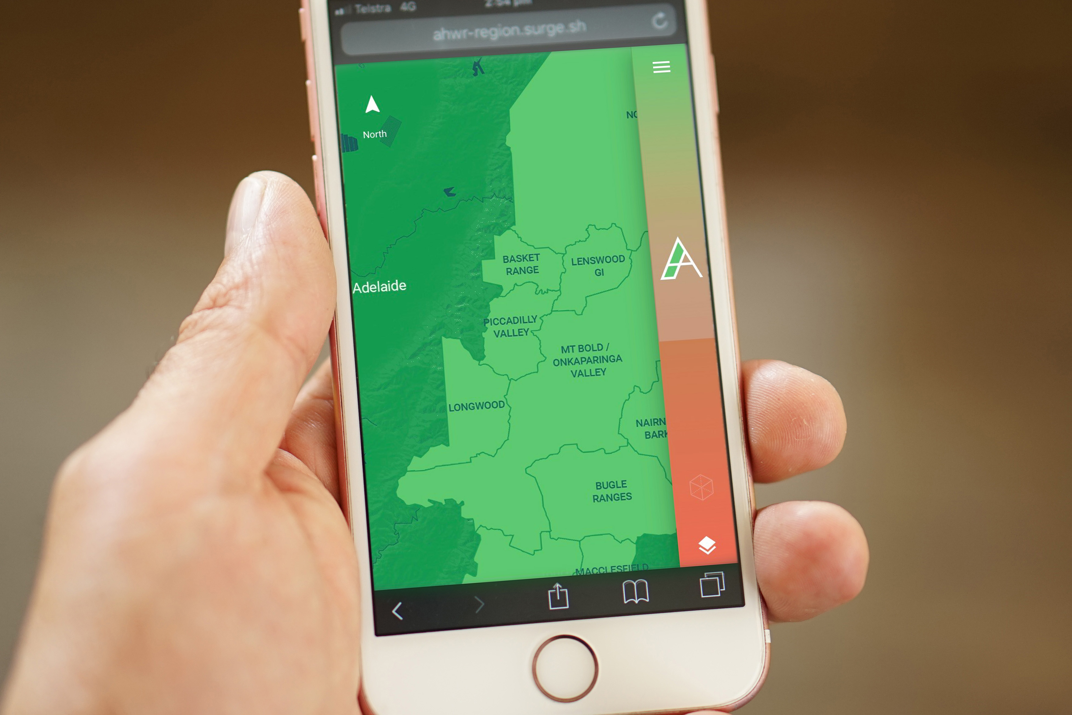
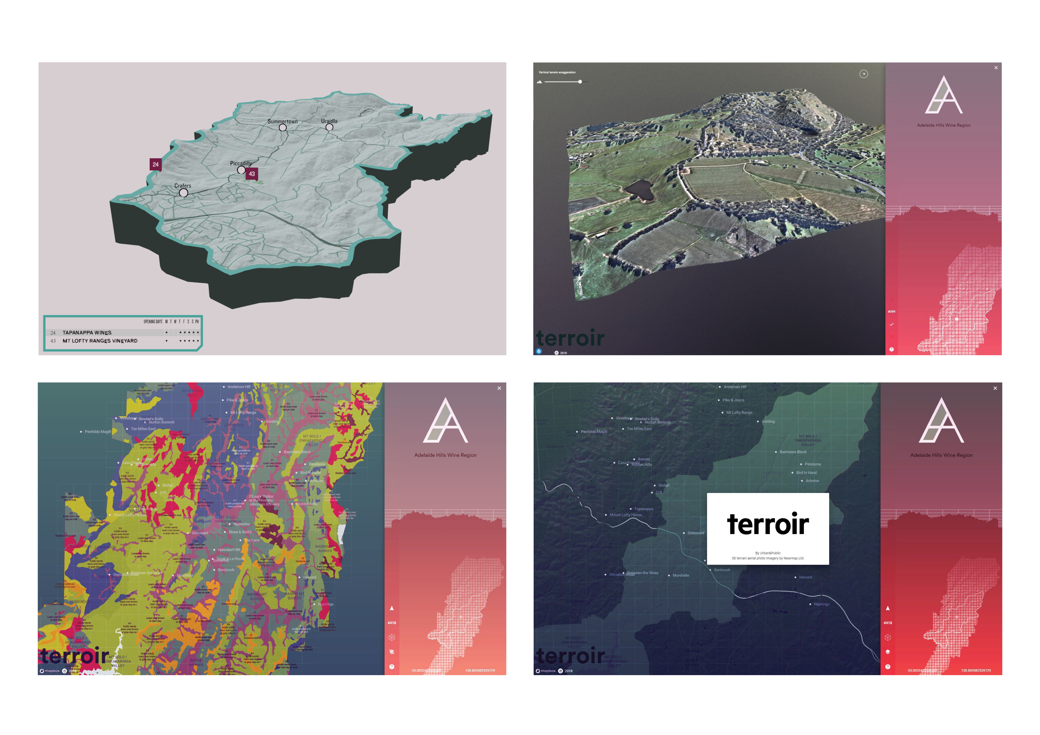
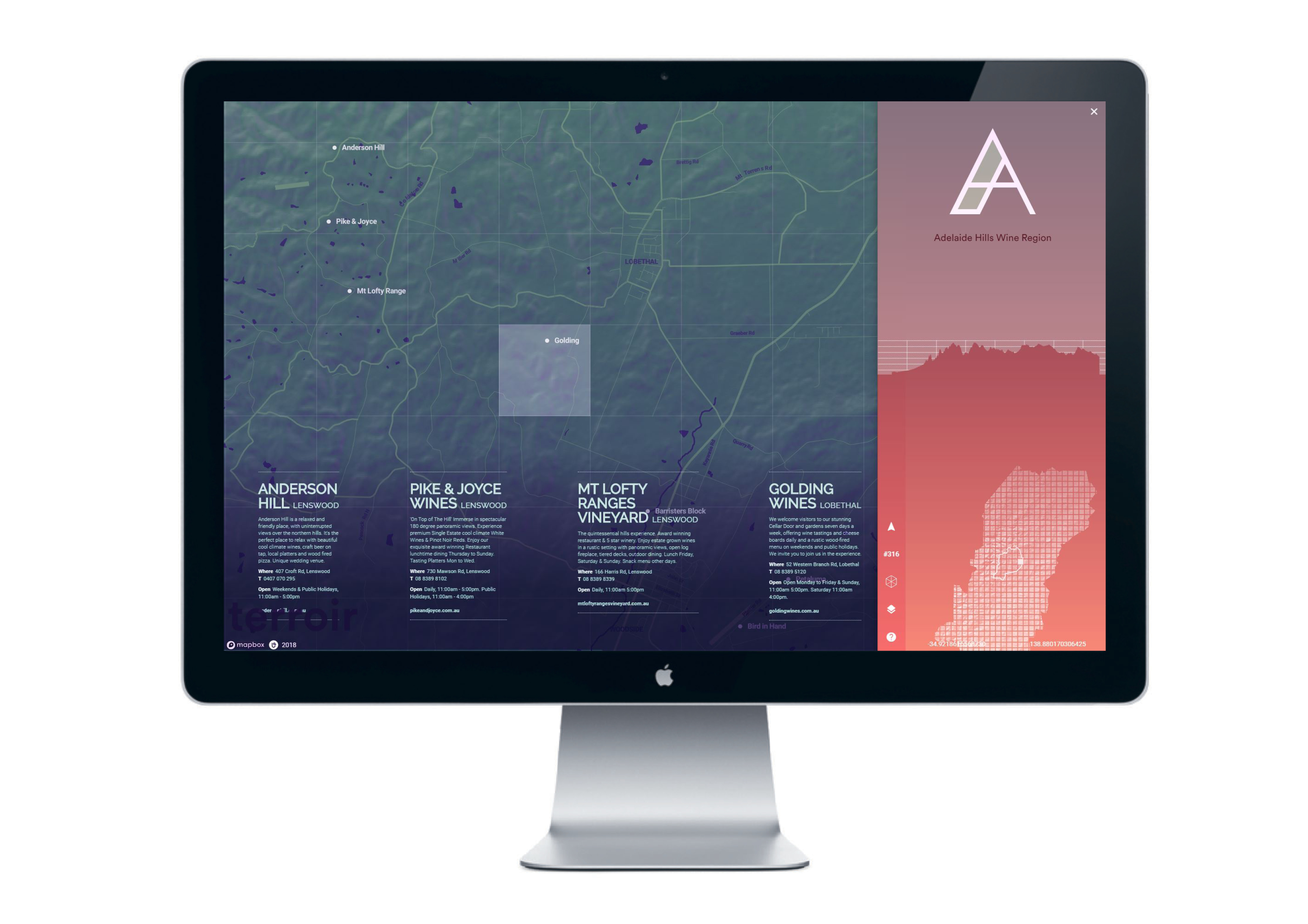
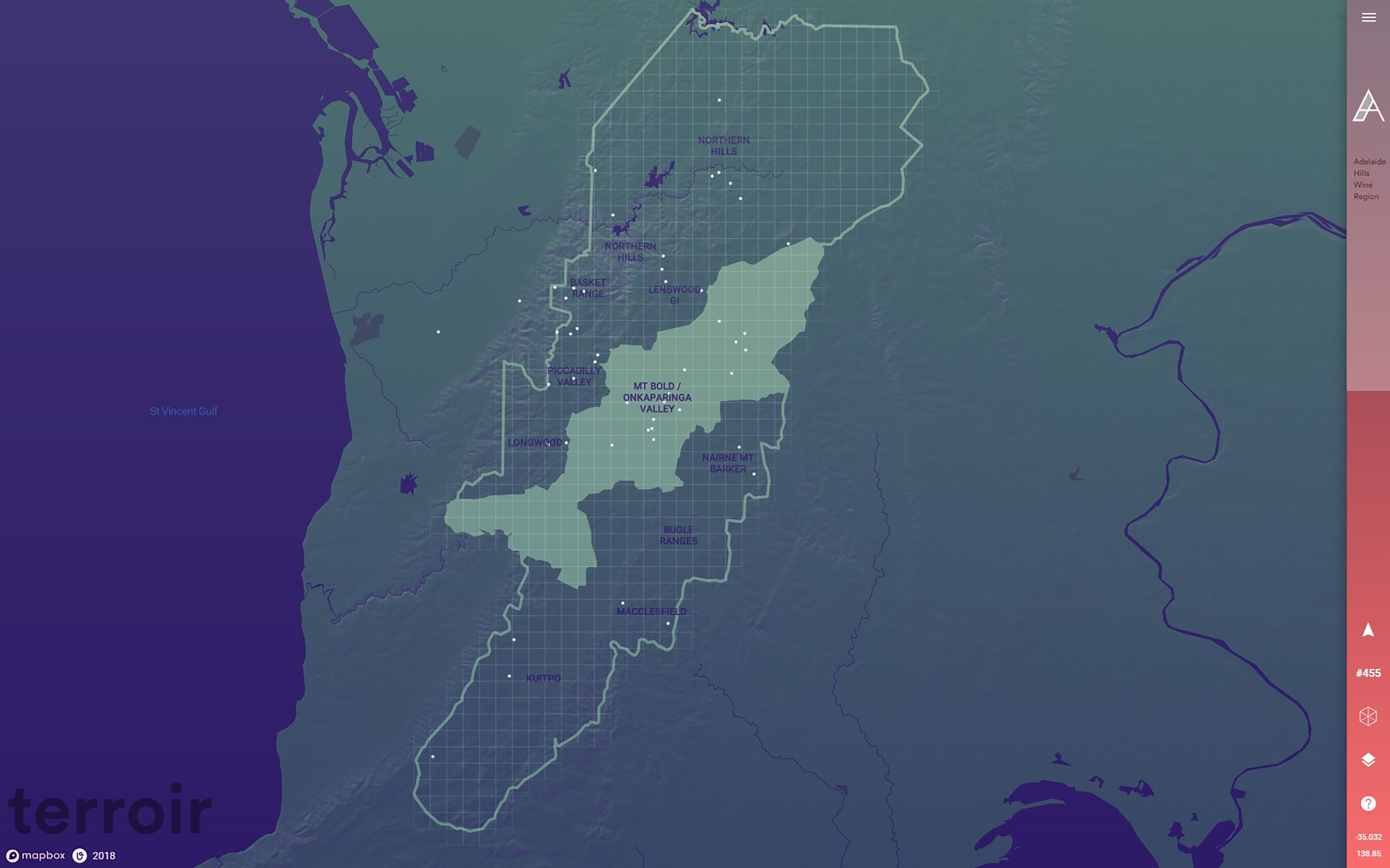
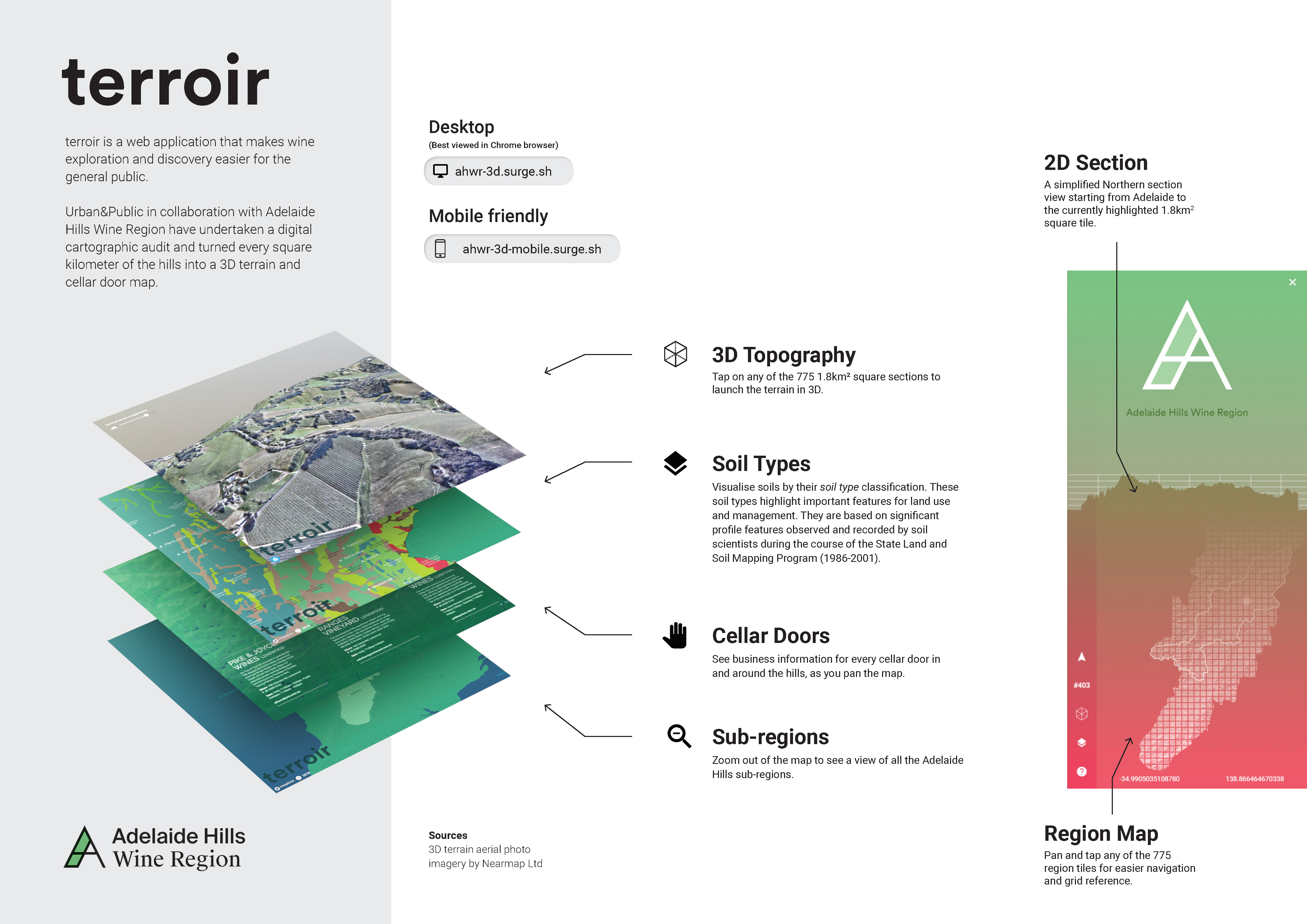
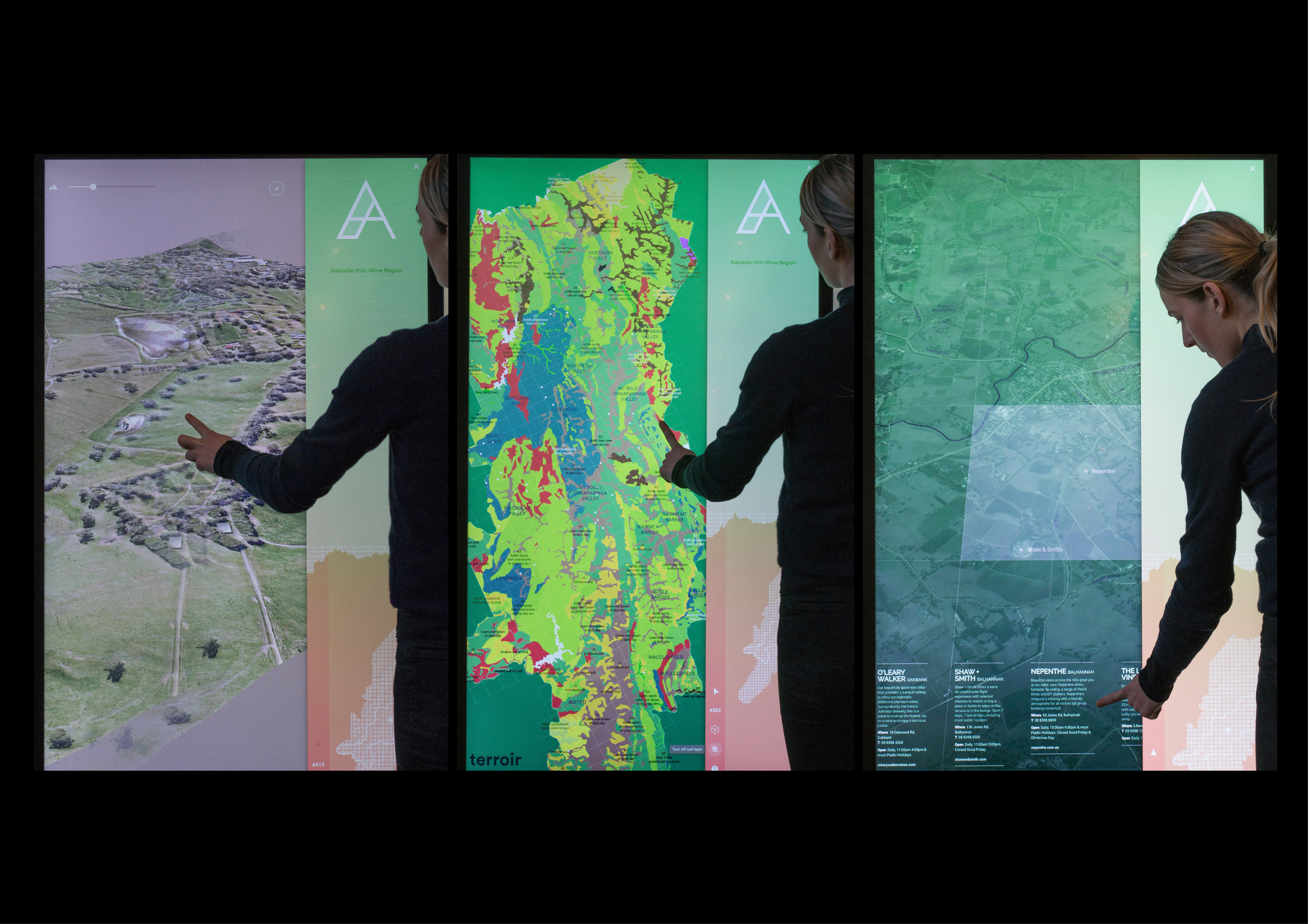
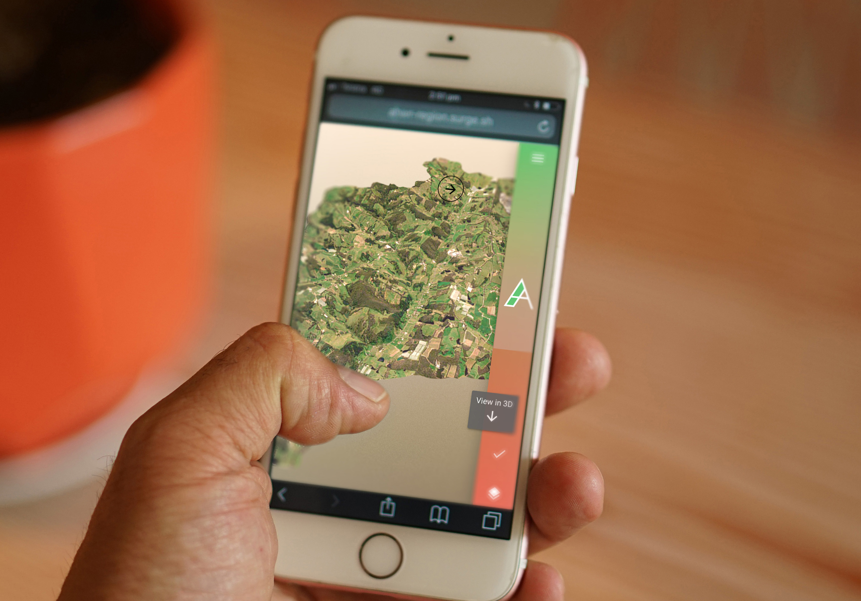
Terroir is a digital map offering an unrivalled experience of the Adelaide Hills wine region. Hand-drawn topographic contours and geospatial analysis lets you discover cellar doors virtually hidden in the hills. The unprecedented platform allows winemakers to convey the terroir, businesses, sub-regions and soil types at conferences and wine tastings.


view website
Buy online

  • CHALLENGE
  • SOLUTION
  • IMPACT
  • MORE
  • How to deliver an engaging digital map of the Adelaide Hills Wine Region in the form of a cross-platform web application to benefit winemakers, businesses and the general public. This with the aim of helping people who are unfamiliar with the region to understand the region’s diverse character, businesses, sub-regions and soil types. The map covered an area of 1460 square kilometres.

  • At present the solution surpasses state-of-the-art mapping platforms in both quality and user experience by incorporating local knowledge and improving accessibility. This was achieved by integrating data sources and APIs—Nearmap, Mapbox and Sketchfab—into a custom geospatial data pipeline to generate 3D terrains and apply physical based rendering for presentation in a responsive front-end web application.

  • The visibility of commercial businesses in the region has improved the exposure and discoverability of winemakers towards the general public. It has provided the Adelaide Hills Wine Region with an enhanced digital presence and a more sophisticated tool to engage overseas audience, including investors unfamiliar with the region.

  • Our grid reference system is an innovative compromise between complex tile-server content delivery and a 3D game-engine experience. It can be viewed in low and high-bandwidth versions.